Lake Lanier was just named the best lake in the country for fall colors, according to a new ranking from BoatBooker published on September 16, 2026, eight days before this story, as reported by WGTJ Radio. The ranking is not a comparison of how vividly Lanier's maples and sweetgums out-blaze the Adirondacks or the Blue Ridge Parkway; its score sheet measures other factors too.
The score sheet BoatBooker released with the ranking shows that its result reflects access as well as a qualifying foliage window. Understanding that difference matters if you're planning to actually go see it in the next two weeks, because the number that should worry you isn't foliage timing. It's the lake level.
What the Score Sheet Measured
BoatBooker built its ranking around four weighted categories: boat access using USGS public ramp data within a 20-mile radius, city proximity using Census population and drive-time routing, foliage timing pulled from satellite vegetation data through the USA National Phenology Network, and a recognizability score based on independently published lake-awareness data. Every lake on the list first had to clear a baseline requirement of a satellite-confirmed foliage peak sometime between September 15 and November 15 just to qualify.
Lanier's line item breakdown, per that same score sheet: 66 boat ramps within 20 miles, worth 13.6 points on the access category. A proximity-to-Atlanta score of 24 out of 30. Another 12 points for recognizability. The table lists foliage timing as a qualification rather than a point value. Two other Georgia reservoirs made the national top 10 alongside it: Lake Hartwell came in at number three and Clarks Hill at number six.
| Category | What It Measures | Lanier's Score |
|---|---|---|
| Boat access | Public ramps within 20 miles (USGS data) | 13.6 pts |
| City proximity | Drive time and population near a metro (Census data) | 24 / 30 pts |
| Foliage timing | Satellite-confirmed peak color window | Qualified (Sept 15–Nov 15) |
| Recognizability | Published lake-awareness data | 12 pts |
Notice what isn't in that table. There's no column for how red the leaves get, how long the peak window lasts, or how it compares visually to a lake three states north. The ranking is a proxy for "easy to reach and easy to launch a boat on, during a window when the trees happen to be turning." Those access factors contribute to Lanier's ranking. Sixty-six ramps inside a 20-mile radius and a straight shot to a metro area of six million people is not a subtle advantage.
What the Ranking Means for Local Leaf-Peeping
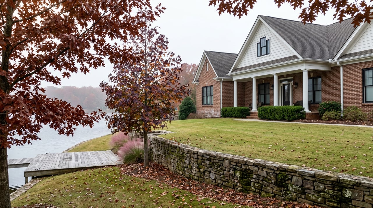
The score sheet provides useful context for anyone planning to see fall color locally. Our hardwoods run oak, hickory, and sweetgum rather than the sugar maples that turn New England into a postcard. The color on Lanier is real but it's a quieter palette, and it earns its ranking through infrastructure rather than intensity.
That's worth knowing before you plan a leaf-peeping weekend expecting Vermont-grade drama. What you're getting instead is genuinely easy access to decent color from more vantage points than almost anywhere else in the country, which is its own kind of win if you live five minutes from a ramp instead of a five-hour flight from one.
The Peak Date, and the Number That Complicates It
The same study projects October 8 as Lanier's peak foliage date this year. That gives residents roughly two weeks from today to plan around it. One other practical factor to consider is the current lake level: as of September 21, 2026, Lake Lanier sits at 1,064.66 feet, which is 6.34 feet below the 1,071-foot full pool mark, and running about 4.18 feet lower than the recent average for this point in the calendar, according to continuously updated USGS gauge readings.
That gap changes the calculus for anyone planning to see this color from a boat rather than from shore. A lake running six feet low is still perfectly navigable on the main body, but the backs of coves and the shallow pockets where the best reflection shots usually happen get a lot less forgiving. Docks sit higher above the waterline than they did in June. Ramps that felt routine at full pool in early summer can leave you second-guessing your draft by the time you're threading into a narrow arm looking for the right angle on the color.
The Better Bet This Year Might Be on Foot, Not on a Hull
If you'd rather not gamble a prop on an unfamiliar cove two weeks before peak, Don Carter State Park solves the problem without needing a boat at all. It's the only Georgia state park directly on Lake Lanier, sitting on the reservoir's north end near Gainesville, and Georgia's own Leaf Watch program singles it out for "brilliant reflections, especially for paddlers exploring quiet coves," listing it among the state's under-the-radar spots for fall color.
A few specific ways to use it over the next few weeks:
- Huckleberry Trail follows a wooded peninsula along the shoreline, with lake views on both sides of the loop and a spur out toward Beach Cove. Easy grade, natural surface, no water depth required.
- Dog Creek Inner and Outer Loops wind through the creek floodplain on gentle slopes, open to both hikers and equestrians, with a couple of bridge crossings if there's been recent rain.
- Flat Island, Lost Cove, and Whale Tail paddle trails give you the water-level view without a boat draft to worry about. Flat Island runs about three miles upstream toward the lake's northernmost island with rocky bluffs and reedy shoreline. Lost Cove crosses the main Chattahoochee channel into a quieter tributary. Both are kayak or canoe routes, not motorized ones, so a low pool doesn't change the experience the way it would for a wake boat.
None of these depend on how many feet the reservoir is running below full pool. That's the actual advantage this particular October, and it's the kind of detail the national ranking had no reason to mention.
The Rest of the Fall Calendar Already Moved Without Waiting for the Leaves
The color isn't the only marker that fall has arrived on the lake. The Lake Lanier Association ran its 38th Annual Shore Sweep on September 19, with more than 1,000 volunteers registered across 15 different locations to pull trash and debris from the shoreline, part of a cleanup effort that has removed millions of pounds of debris since it began. If you missed it this year, it's worth putting on next September's calendar, because it's become the informal marker that summer traffic on the lake is winding down and the quieter season is starting.
There's a second thread running through this fall that connects directly back to the water level conversation above. WGTJ Radio reported that a group called My Lake Lanier has started a letter-writing campaign to the Army Corps of Engineers over a proposed resumption of dredging on the Chattahoochee River downstream of Buford Dam. Their concern centers on what that work could mean for lake levels, water supply, drought resilience, and boating safety on Lanier itself. The Corps is still in its planning and public input phase, with no final decision yet on whether dredging resumes. It's not a real estate story and it's not a scare headline, but it's the kind of local thread that explains why residents pay closer attention to that USGS gauge reading than a tourist ever would.
Planning Around the Fall-Color Window
If you want to see the color from the water, check the draft in your specific cove before you commit to a route you haven't run recently this season, especially anywhere off the main channel. If you'd rather skip that gamble entirely, Don Carter's shoreline trails and paddle routes give you the same reflections without needing six feet of extra pool elevation to get there. Either way, October 8 is the number to build a weekend around, understanding that satellite-based projections shift by a few days depending on rainfall and temperature between now and then.
The ranking reflects Lanier's access during the fall-color window, rather than the intensity of its foliage. It's not the most colorful lake in the country. It's one of the easiest ones to actually get to and launch on during the two or three weeks a year when the hardwoods along its shoreline turn. That distinction is useful context for anyone planning around the fall-color window or considering life near the lake.
Amy Scott has spent her career learning Lake Lanier at this level of detail, not just the version that shows up in a national press release. If you're weighing a move to the lake, evaluating a waterfront property, or just want to talk through what a season like this one means for a specific stretch of shoreline, reach out through Amy Scott and request your free home valuation to start the conversation.