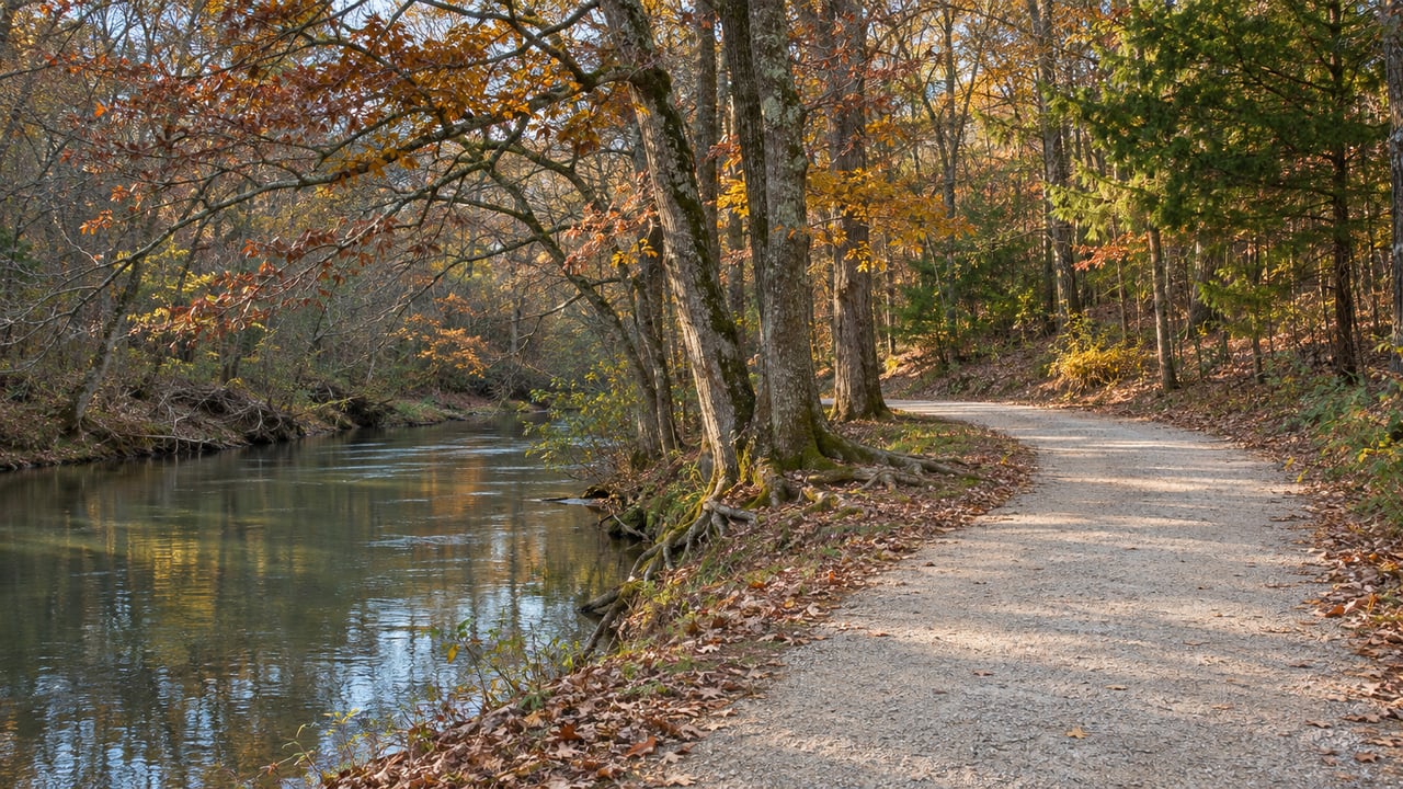
At the far end of the Mulberry RiverWalk there is a monument and a small rest area at the spot where Barrow, Gwinnett, Hall and Jackson counties meet. For most walkers it is the point where they turn back. A round trip from the Liberty Church Road trailhead is 4.4 miles on crushed slate along the Mulberry River, with very little climbing. The rebuilt surface reopened last December, so this is the first fall on the new trail. It's a good choice for Thanksgiving weekend, when the house is full and everyone needs an hour outdoors.
The trail is easy to misplace, even for people who live in Braselton. It isn't the downtown Braselton riverwalk you may have heard about, and it isn't a section of the Braselton LifePath. The Town of Braselton lists the Mulberry RiverWalk as its own park, along the river north of Interstate 85, and lists it apart from the Town Green on Davis Street. The LifePath is a network of 10-foot-wide concrete paths along Highway 211 and Thompson Mill Road that connects residents to the businesses on those roads. The RiverWalk is a soft-surface river trail on land the town bought to protect its water supply. Each one suits a different kind of outing.
Start at 940 Liberty Church Road
The main trailhead and free public parking are at 940 Liberty Church Road. The trail is open every day from sunrise to sunset. In late November that closing time comes early, so plan around it. For a 4.4-mile round trip at an easy family pace, start after lunch rather than late in the afternoon.
There is a second entrance at Silk Tree Pointe. It is a walk-in access point inside the Mulberry Park subdivision, and Explore Georgia lists it as an access point to the Four Corners Monument. The town calls it a trailhead with limited parking, so Liberty Church Road is the better place to meet a group. In late September the town scheduled contract crews to clear vegetation on the section between the Liberty Church Road trailhead and Silk Tree Pointe, so that stretch has been trimmed back this season.
The trailhead has no public restrooms. The nearest town-listed restrooms are at the downtown parks. One is in the concession building next to the Town Green, and another is in the white building behind the Community Center beside Braselton Park on Harrison Street. If you have kids or older relatives along, stop downtown first.
The Surface Was Rebuilt for This
When the RiverWalk last closed, the trail itself was not the reason. The town shut it beginning March 21, 2022, for a streambank restoration on the Mulberry River meant to protect town water and wastewater infrastructure along with the trail. MainStreet News reported the streambank work at nearly $2.3 million, financed through a zero-interest loan from the Georgia Environmental Finance Authority. The Gainesville Times reported on Nov. 9, 2022, that the trail had reopened with more work still to come.
That second round of work finished last December. MainStreet News reported in its Dec. 24, 2025 edition that the project resurfaced two miles of the 2.3-mile trail, from the trailhead to the point where it enters Hall County. The money came from Barrow County SPLOST, plus a small share of Gwinnett SPLOST. The same project stabilized the riverbanks, planted bushes and trees, and added steps down to the river. In that article, Town Manager Jennifer Scott called the result "extraordinary" and said, "It might be my favorite project we've ever done."
The town says it chose crushed slate to reduce erosion and mud. The same surface affects who can use the trail comfortably. The town notes that the slate is soft and may be hard going for bicycles and wheelchairs. Strollers with small wheels will have a similar time of it. For a guest who uses a wheelchair, the concrete LifePath is the better holiday walk. For everyone else, the slate is easier on the knees than pavement and stays far drier underfoot than the old trail did after rain.
What You Pass on the Way Out
The trail is well marked, with new signs at the parking lot entrance, at the trailhead and along the route. More benches went in during the rebuild. Explore Braselton also lists perennial gardens, footbridges and picnic spots along the way. If you bring sandwiches, you can stop to eat halfway instead of rushing back to the car.
The RiverWalk also has its own art. Sculptor Brian Seay donated an art installation to the trail. Explore Braselton lists the piece as "Horizon's Window," and the town held a recognition for Seay at the sculpture site on June 2, 2025. Explore Braselton's guide to public art in town also lists a RiverWalk mural by Braselton artist Chris Hobe. When the resurfacing wrapped up, MainStreet News reported that the town and the Braselton Arts Council planned a large Hobe mural on the wall around a lift station, plus more murals on the well houses along the trail.
Dogs are welcome on a leash, and owners are expected to clean up after them. Pack bags for the full 4.4 miles before you leave the car.
The Turnaround Where Four Counties Meet
The resurfaced trail ends at the four-county monument, and that is the destination of the walk. Barrow, Gwinnett, Hall and Jackson counties all touch at that one point, and the town has put a monument and a small rest area there. A family photo there puts everyone in four counties at once.
The out-and-back distance makes the outing easy to size. Walking all the way to the monument and back is the full 4.4 miles. A group with mixed stamina can split up there. The faster walkers go on to the monument and the others turn around at a bench or picnic spot and wait at the trailhead. Because the trail runs along the river with minimal elevation change, the walk back takes about as long as the walk out.
Where the Trail Is Headed Next
The monument is the end of the trail for now, but the town plans to go farther. As of December 2025, MainStreet News reported that the town was designing an extension from the four-county monument into Hall County out to the town limits. It would bring the trail to about 4.5 miles and add a second parking lot, and town officials hoped to connect it to the trails at Northeast Georgia Medical Center Braselton.
For this holiday season, the walk is still the out-and-back from Liberty Church Road to the monument.
Plan the Walk Around Daylight and Restrooms
The RiverWalk works best when you plan it like a short hike. Start at 940 Liberty Church Road, with Silk Tree Pointe as a backup entrance with limited parking. Use the restrooms downtown before you go, and finish before sunset. The town says the RiverWalk sits on more than 200 acres it bought along the Mulberry River, which is an important drinking water source for the community. That is why the trail feels so separate from Highway 211 and the I-85 interchange, even though both are a short drive away.
The town usually holds volunteer cleanups on the trail twice a year. You can report a downed tree or a washed-out spot any time by calling the Town of Braselton at 706-654-3915. For the rest of the season's plans, the Braselton holiday calendar covers the evening events downtown.
If your Thanksgiving walk to the four-county monument has you wondering what your own place on the Mulberry River side of Braselton is worth, Amy Scott can put a number on it. Request your free home valuation.